Barents Sea Bound by Low Arctic Sea Ice – NASA Science

Dark open water south of thin, broken sea ice near Franz Josef Land, with thin clouds covering part of the area.

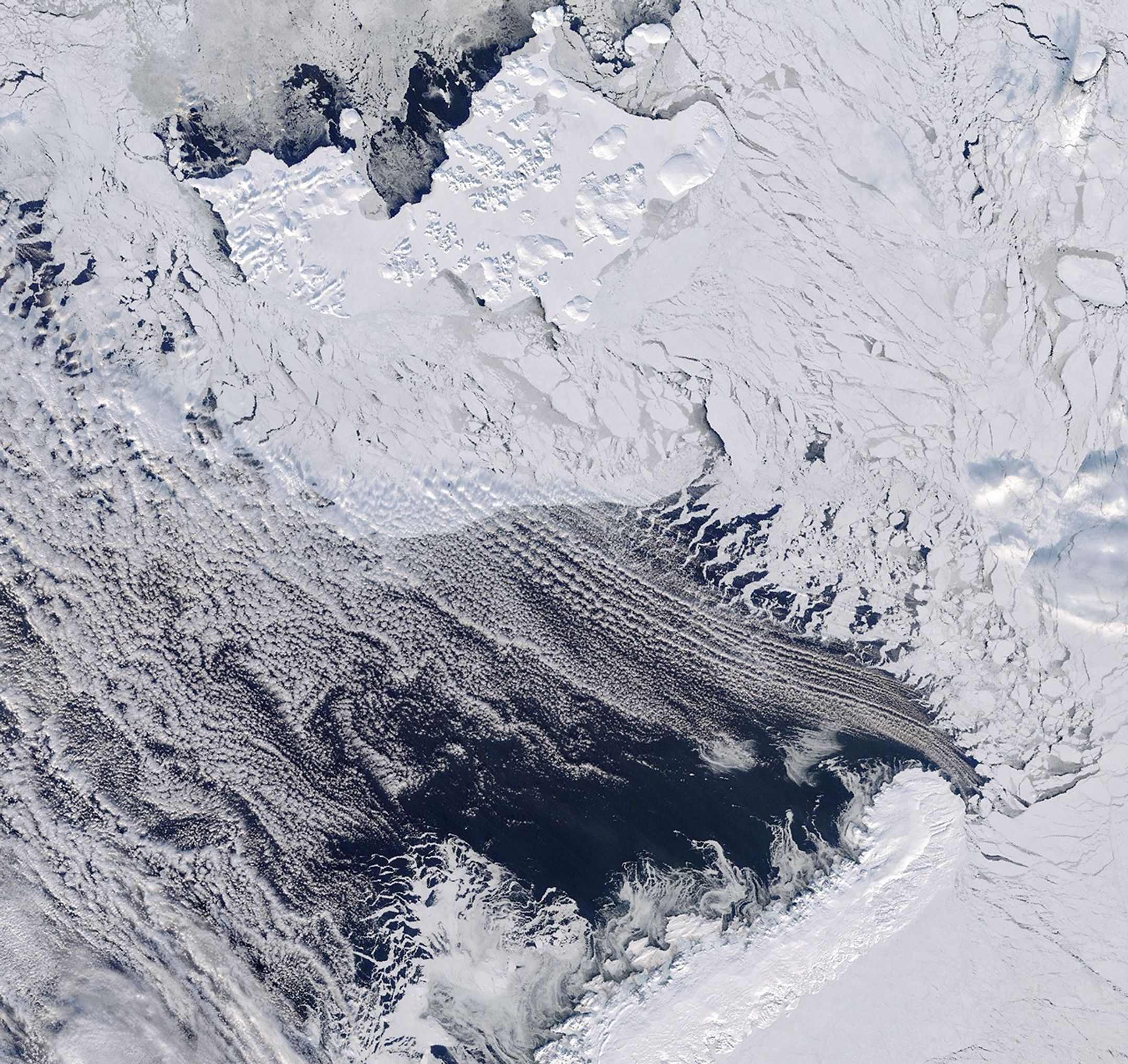
At the surface of the planet, sea ice across Arctic waters grows and shrinks seasonally, usually reaching its annual maximum in March. In 2026, this peak occurred on March 15, when the measurement reached 14.29 million square kilometers, which is the lowest level observed since satellite monitoring began in 1979. One of the important areas … Read more

Concept of the Uranus CASMIUS Mission to Explore the Great Secrets of Ice

Image of Uranus taken by NASA's James Webb Space Telescope's Near-Infrared Camera (NIRCam). Along with the rings, this image also shows nine of Uranus' 27 moons. (Credit: NASA, ESA, CSA, STScI)

The ice giant Uranus is one of the most fascinating objects in the solar system, with its side-by-side rotation, complex ring system and unique family of moons. However, it is also one of the least studied objects in the planetary system, due to its extreme distance from the Sun. While NASA’s Voyager 2 spacecraft remains … Read more

‘Frightening’ winter sees Arctic sea ice hit record low for second year – Carbon Brief

Daily Arctic sea ice extent for 2026 and 2025, with decadal average and 2012 low compared, based on data from NSIDC. Chart by Carbon Brief

Arctic sea ice has reached its peak this winter, and is at its lowest point in the satellite record going back nearly half a century. Interim data from the US National Snow and Ice Center (NSIDC) show that sea ice extent peaked at 14.29 square kilometers (km2) on March 15. This is slightly less than … Read more